Great point - salt kills!
1 Like
As does pressure.
Besides which, any sediments deposited in a flood would not get carried to the tops of mountains, they would wash away as those mountains rose, given that all the mountains in the world supposedly rose during the flood year.
1 Like
A worldwide flood cannot explain anything unless it has specific characteristics. Where does the water come from? Where does it go? How fast is it moving? Is it fresh or salt? Only with such specifics is it possible to honestly claim that the flood is explaining something. Otherwise, the flood is being used as a magic excuse to ignore every piece of evidence for an ancient earth, without a basis in honesty.
The global flood of modern young-earth imagination cannot explain the series of layers found around the globe. Geology recognized that in the late 1700’s. For example, many layers, of various ages worldwide, contain extensive salt deposits. But to deposit salt, you need to have the water salty enough kill most organisms. A region of the ocean, getting isolated from the rest of the ocean, can get very salty, but for a global flood to make salt layers, you’ve killed most ocean life, everything freshwater, and all the seeds. Global variations in stable isotopes require time to form. The sequences of fossils have already been mentioned. The fossil record contains numerous hardgrounds, such as reefs, which Kurt Wise (a young-earth advocate) admitted can’t form during a modern young-earth style flood. The Miami area has fossil reefs, with corals similar to the modern shallow-water reef corals living nearby. They had to grow in clear water, not water that’s dumping enormous amounts of sediment like current young-earth models claim happened in the Flood. But they are on top of lots of other layers, which young-earth models claim were deposited during or after the Flood. When since the Flood is there time to have the ocean much higher than today for long enough that large corals grew?
Ocean currents promote cooler, more nutrient-rich water rising from deeper in the ocean near the equator. In turn, silica-skeleton microplankton like diatoms and radiolarians thrive under those conditions. This leads to a large pile of silica skeletons on the seafloor near the equator. This silica pile can be traced deeper and deeper in the sediment as you go northwest from the equator, in the direction the plate is moving. In other words, there was enough time for enormous numbers of algae and other microorganisms to live, die, and pile up as the plate slowly moved across the equator. Similarly, long series of volcanic islands have had time to form, erode, and sink as the plate moves over a hot spot.
These are but a few examples. Old-earth models explain the observed features of the earth well. Young-earth models don’t.
5 Likes
Thanks for sharing the article.
If I understand it correctly, sedimentary layers form on continental shelves. What then? How do they move to all parts of the continent? Many steps are not stated.
Is that a bad thing? Of course those with contrary ideas aren’t going to like it.
It’s got to be pretty awful for YECs to not keep it in their pseudoscience library!
If you are interested in taking the time, read the book and check out the supporting evidence. If you haven’t read it, I’m don’t know how you can claim there is no supporting evidence. I can supply some rhetoric, the supporting evidence is there for your pleasure if want to see (read) it.
As a general principle, since YECism’s pseudoscience has been so thoroughly debunked every which way, no one who is scientifically literate is going to take the time to and certainly is not going to take any pleasure in reading yet another attempt to force physical reality to conform to early Genesis.
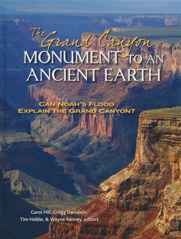
On the other hand, this is worthwhile – a beautiful book, and of the eleven contributing authors, nine are evangelical Christians: The Grand Canyon, Monument to an Ancient Earth: Can Noah’s Flood Explain the Grand Canyon?
1 Like
From an inset in the book that is not Grand Canyon related is this little piece:
2 Likes
Continental shelves, river deltas, and inland seas. Followed by uplift by processes such as continental drift. The Alps and the Himalayas, for example, both formed as a result of tectonic plates colliding with each other.
5 Likes
The only two factors coordinating a portion of sedimentation patterns globally are 1) the rise and fall of sea levels due to variation of ice and temperature over geological time. Tectonic movement complicates the picture, as plate collisions and uplift are major factors in local sedimentation histories, and the appearance of mountains and plateaus are not synchronized with global sea level at all. 2) the other identifiable sediment is the fallout from the Chicxulub extinction event which deposited a common layer found in many locations world wide.
Flood proponents maintain that all this sediment is generated in one year, and somehow hundreds of millions of years is not adequate? That is some mindset.
The Rocky mountains were at one time as high as the Himalaya’s, and cities such as Calgary and Denver sit on downward sloped plateau’s of sedimentary rock east of the continental divide, in a process measurable and continuing today. How does this support any catastrophic event?
This erosion process can be viewed with one’s own eyes by looking at the Hawaiian and Galapagos islands chains, where there are progressions from younger volcanic islands with high peaks hosting one of the world’s best telescope sitings, to older and more eroded, to completely washed away and submerged mounds.
3 Likes
It is only 120 pages, but here is a US Geological Survey publication to get you started.
1995 - Paleogeography of the Late Cretaceous of Western North America
And this will provide an introduction to sequence stratigraphy
Sequence Stratigraphy: Methodology and Nomenclature
I’m sure that after studying these and supporting papers from their references, you will be more than satisfied that plenty enough steps are stated fully and in painstaking detail.
1 Like
Explanations are not evidence. Evidence of hydroplane theory would be such things as data, measurements, physical results of it happening. Footnotes and references would be to papers, research, studies, not to other books making similar unfounded assertions. I just don’t see that in looking at the books notes and footnotes. It pretty much just makes circular arguments that are cohesive only within the closed loop of that subculture, which to me seems more akin to Narnia than reality. And I love Narnia, but it is not real.
1 Like
This is well done and not difficult to understand about the Hawaiian island and Emperor seamount chain and should be compelling evidence for the antiquity of the earth:
https://biologos.org/blogs/guest/how-old-are-the-hawaiian-islands
3 Likes
Sedimentary layers form anywhere that sand, mud, or gravel can pile up. If you’ve seen dirt, you have seen sedimentary layers forming. Lakes, floodplains, valleys, the deep ocean, glacier edges, all sorts of places. These different places have different patterns of wind or water moving things around, producing different types of sediments and different layers. Desert sand dunes are very different from deep-sea muds, which are different from beaches, which are different from reefs, which are different from swamps. The rock record preserves evidence of these different sedimentary settings, and thus clearly indicates a long history of ordinary environments. The claim that these are all from one giant flood is not geologically honest. In fact, the possibility that a global flood was responsible for a certain distinctive layer was a geologically viable idea over fifty years after it was unambiguously clear that the total age of the earth had to be quite old. Eventually, it was found that the puzzling deposits better matched glacial deposits than flood deposits, leading to the recognition that the long-standing idea that Noah’s flood was a regional disaster was the best match for the evidence.
4 Likes
Along with all the soil bacteria and fungi and such that make the big difference between mere dirt and functional soil.
Sedimentary layers form in lakes, in inland seas, at the ends of glaciers, and under the right conditions in other places; pretty much any place that is lower than the surrounding area and there is water and/or wind to carry particles such as sand or silt.
I’ve read reviews of the book by actual geologists with PhDs in geological physics. Those made it clear that reading it myself is most likely to be a waste of my time. I also watched the video at that site and have to say that he’s totally out of his depth and most of what he says is best described as bad science fiction.
His claim about where sediments come from is totally incompatible with the actual sedimentary deposits, as is his claim about the fossil record – and those are just two of the problems.
Correction: that last should read, “force physical reality to conform to a false reading of early Genesis”.
Read as the ancient literature it is, .Genesis gives no indication as to the age of the Earth and has no interest in communicating science.
2 Likes
Speaking of viewing with one’s own eyes – joining in a Hydraulics (Geology) course field trip, it was interesting to see how there are rivers that desposited substantial layers of sediment, the lower parts of which lithified, and then the same river, no longer carrying a heavy sediment load, cut down through the soft layers and then into the sedimentary rock deposits. The canyons and channels left by this process cannot be explained by any massive flood event.
I skipped saying this because I was confident you’d tackle it.
Actually Narnia is more logically cohesive.
4 Likes
My house sits on alluvial deposits that are fascinating to dig down through, something my dad and I did once when dealing with a sinkhole in the back yard. Soil layers in between sand, gravel, and mixes of those show that the land here has been above the tide line and below it, something not possible with a single event: soil means dry land, sand indicates estuarian deposits, and gravel indicates material moved by flooding rivers. In a single flood event there would only be one soil layer – so just on my own property the geology refutes a global flood.
3 Likes
If you read the book you will find exactly what you are looking for. As well as predictions that have been verified. Since you have not read the book I would again encourage you to read it. There is nothing to be afraid of, the book won’t bite.